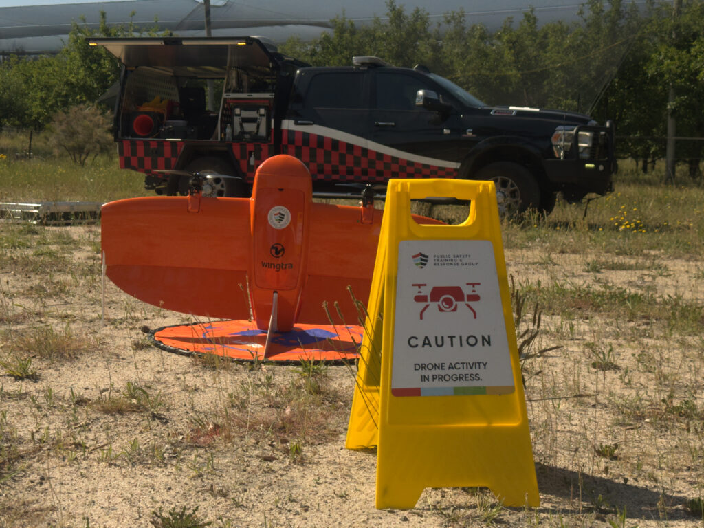
A specialised powered-lift drone, the Wingtra has been described as ‘a game changer’ for a Stanthorpe apple farmer who needed a quick and accurate assessment of storm damage to his crops.
The uncrewed team at Public Safety Training & Response Group conducted the aerial assessment in 45 minutes, replacing a manual task that would have traditionally taken days for the farmer and his staff.
The team carried out the project using the Wingtra Gen 11, a powered-lift drone that utilises vertical take-off, allowing its launch from just about any situation, but then transitions to fixed-wing flight to soar across the assessment areas, similar to an aeroplane. It is an ideal craft for capturing high-resolution images, mapping large areas and digital terrain modelling and surveillance – accurately, quickly and efficiently.

Collects imagery with pre and post disaster planning and assessment
The Wingtra Gen 11 is particularly useful for collecting imagery for use with pre- and post-disaster planning and assessment, which is exactly how it was used in the case of the orchard job north of Stanthorpe.
“Using the Wingtra drone to assess storm damage on the orchard has been a game changer,” says Jason Alcorn, Head of Uncrewed Operations at Public Safety Training & Response Group.
“The speed and accuracy with which we can now survey the damage – especially in areas that are difficult to reach – saves hours of manual labour.
“What would’ve taken days to inspect on foot, we managed to complete in less than an hour, with the bonus of collecting some useful ongoing data.”
The use of drone technology is a valuable development for farmers in the Granite Belt Region, which has historically been impacted quite regularly by hail during the summer – in some seasons, hail has damaged up to 60% of apple crops.
Public Safety Training and Response Group provides numerous drone solutions for countless problems
The crop damage assessment project is just one of the many tasks able to be carried out by the drone team at Public Safety Training and Response Group
The Group provides numerous drone solutions for countless problems: providing aerial photography for industries like real estate, traffic management, surveying, and farming, through to technical and complex tasks such as inspections of powerlines, buildings, dams, pipelines, bridges and roads, confined space inspections such as inside pipes and sewage systems.
The applications together with the technology can help gather accurate and valuable data quickly, improving the planning and the results.
Drone technology extends to applications such as LiDAR (Light Detection and Ranging) mapping, ground penetrating radar imagery, radiation detection, magnetometer surveys to detect UXO, hidden mineral exploration, and article searches, Law Enforcement Support, payload delivery; and the use of Fotokite, providing public safety teams with mission-critical situational awareness from elevated perspectives.
For enquiries and advice on how uncrewed technologies can save time and money while enhancing safety in your industry, contact Public Safety Training & Response.

